


Gyeonggi Province CCTV and Water Level Gauges Become 'AI Eyes' to Prevent Disasters
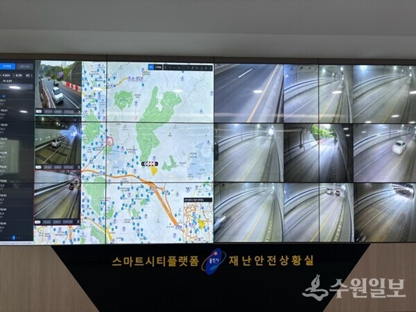
The Gyeonggi Research Institute released a report on December 12 titled "How is Artificial Intelligence Changing Disaster Response Methods?" which presents directions for AI-based disaster response.
The report does not limit AI's role to merely predicting disasters, but instead identifies methods to apply AI across the entire disaster management process: 'prevention' to identify risks beforehand, 'preparedness' to ready for disasters, 'response' to quickly understand on-site situations, and 'recovery' to verify damage and provide support.
According to the World Meteorological Organization (WMO), approximately 30% of the global population still lacks access to adequate early warning services. However, analysis shows that providing warnings just 24 hours before a disaster occurs can reduce damage by 30%.
The Gyeonggi Research Institute believes Gyeonggi Province has a good foundation for implementing AI-based disaster response. In 2025, Gyeonggi Province received Grade 1 ratings in 5 out of 6 categories—including traffic accidents, fires, and daily safety—in the Regional Safety Index, and in the 2026 disaster management evaluation, it recorded 'excellent,' the highest grade for metropolitan autonomous governments.
Additionally, approximately 195,000 CCTV cameras at 31 integrated smart video centers across cities and counties, as well as existing observation infrastructure such as flood detection devices and reservoir water level gauges, can be connected with artificial intelligence.
The report suggests that Gyeonggi Province's approach of connecting already-owned CCTV cameras, water level gauges, and meteorological and spatial information with AI is effective. The proposed method involves creating a 'Gyeonggi Province Risk Map' marking urban flooding, forest fire traces, and potential steep slope collapse areas using public satellite data and open-source AI, and applying AI to CCTV systems to detect fires, smoke, and abnormal water levels.
Following the example of Guri City, which independently developed a model predicting water levels of the Wangsuk Stream 1-3 hours in advance using public data from the Korea Meteorological Administration and Han River Flood Control Office, the report also proposed connecting pilot projects of cities and counties with common data and standard systems at the Gyeonggi Province level.
Kim Tae-hyung, research fellow at the Gyeonggi Research Institute, stated, "The goal of AI in the disaster field is to identify risks faster, convey information without omission to those in need, and translate that into actual action. For Gyeonggi Province, it is important to conduct demonstration projects on a small scale using existing infrastructure, sufficiently verify effects compared to existing methods, and then gradually expand step by step."
Loading comments…