Historical Journey Meeting Prehistory at Horogoruru Fortress Where the Spirit of Goguryeo Flows
Pyeongwhanu-gil is the northernmost walking trail connecting four municipalities in Gyeonggi Province's DMZ border region (Gimpo, Goyang, Paju, Yeoncheon). Walking along the barbed wire fences near the DMZ allows visitors to experience the reality of national division while appreciating outstanding natural scenery and historical traces. Opened in 2010, Pyeongwhanu-gil consists of 12 courses with a total length of approximately 189 km. It comprises 3 courses in Gimpo, 2 in Goyang, 4 in Paju, and 3 in Yeoncheon.
Pyeongwhanu-gil, adjacent to the DMZ, captures the characteristics of all four seasons. As autumn arrives, Gyeonggi Province introduces Course 10 of Pyeongwhanu-gil under the theme 'DMZ Contemplation (四色)' to allow visitors to slowly savor the seasonal colors.
Pyeongwhanu-gil Course 10 is the 'Gorangpo Path' that follows the Jangnam-myeon area of Yeoncheon-gun and the Imjin River region. Walking through rivers, harbors, royal tombs, and ruins, visitors can encounter traces of our ancestors spanning from the Prehistoric Age through the Goryeo and Three Kingdoms periods, tracing back only about 100 years into the past.
◇ Prehistoric Journey Beginning at Jangnam Bridge
The starting point is Jangnam Bridge, which is quite remarkable from the outset. During reconstruction work in 2008, Paleolithic artifacts including hand axes were excavated, demonstrating that the Imjin River region was an important living ground for people since prehistoric times.
Passing through the riverside and fields, the path enters Sami Stream, the site of the 'Pork Chop Hill Battle' during the Korean War, where UN forces and Chinese forces engaged in fierce combat over the river. Controlling this area became crucial to protecting the Imjin River. Walking along the Imjin River, visitors enter Nogok-ri Village, where late autumn walks reveal the charm of reeds. The village name Nogok-ri (蘆谷里) derives from the lush reeds that flourished there.
◇ Meeting Dolmens and Stone Cairn Tombs: Traces of Imjin River Inhabitants from Thousands of Years Ago
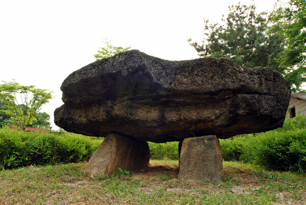
Entering Hakgok-ri beyond Nogok-ri, history traces back to the Bronze Age. A massive dolmen stands in the center of the village. Dolmens from that period are known to be tombs of the ruling class with economic power and political authority, and the Hakgok-ri Dolmen's 2.7-meter-long basalt capstone is particularly striking.
After about a 10-minute walk from here, visitors encounter a stone cairn tomb estimated to have been built in the early Baekje period. Encountering these two relics in succession naturally evokes imagination about the lives and power of ancient people who lived on the Imjin River.
Walking toward the endpoint, visitors encounter Sungui Hall (Sungui-jeon), built to honor the Goryeo dynasty. Created during the Joseon period, it is a royal shrine where sacrificial rites were performed to honor Goryeo kings and meritorious subjects. The neat composition and tranquility unique to a sacrificial space harmonize well with September's seasonal atmosphere. Upon reaching the site of Sungui Hall, Course 10 of Pyeongwhanu-gil concludes, but returning to the starting point of Jangnam Bridge reveals locations worth highlighting.
◇ Gorangpo Harbor, the Commercial Center of the Imjin River, and King Gyeongshun's Tomb Behind It
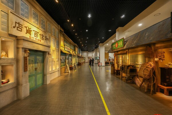
About 5 km from Jangnam Bridge lies Gorangpo Harbor, the central trading hub of the Imjin River. So prosperous was this hub that a branch of Hwashin Department Store opened here in the 1930s, making it a vital center for commerce and logistics. However, after the fierce Korean War, the harbor's functions disappeared, leaving only the sound of gently flowing river water to evoke the transience of time. Nevertheless, visiting Gorangpo Harbor Historical Park vividly recreates the bustling scenes of that era.
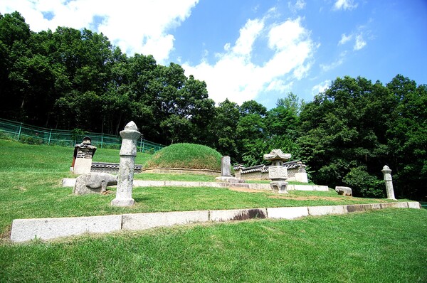
Climbing a gentle slope behind Gorangpo Harbor, visitors encounter the tomb of King Gyeongshun, the last king of Silla. This unfortunate monarch, who had to cede his thousand-year kingdom to Goryeo, has his tomb in Yeoncheon, Gyeonggi Province—uniquely, the only Silla royal tomb located outside Gyeongju. A prevailing theory suggests that during the early Goryeo dynasty, royal tombs were controlled under the mandate that they "must be located within 100 li of the capital, Gaegyeong."
As time passed, King Gyeongshun's tomb faded from people's memory, and its location became unknown. In 1747 (the 23rd year of King Yeongjo's reign during the Joseon dynasty), a stone monument inscribed with "The Tomb of King Gyeongshun of Silla (新羅敬順王之陵)" was accidentally discovered nearby, bringing it back to light. Subsequently, the tomb was again neglected amid the tumultuous modern history of Japanese colonial rule and the Korean War, until an Army captain conducting inspections in the DMZ civilian control zone accidentally rediscovered it, allowing it to be restored to its present state as a royal tomb. Perhaps King Gyeongshun, who gazed toward his homeland yearning achingly and could not rest peacefully, has finally found peaceful slumber, having endured the difficult history together with his descendants.
◇ Horogoruru Fortress Overlooking the Imjin River and the Unification Hope Festival
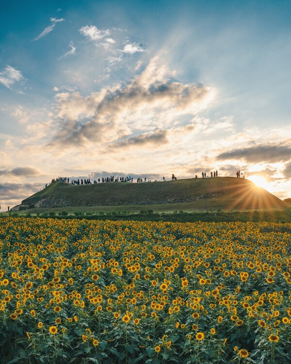
From Gorangpo Harbor, the path leads to Horogoruru, a representative relic from when Goguryeo expanded its territory. Standing on this fortress wall built with basalt, the entire Imjin River area comes into view—a naturally fortified position. One can feel the spirit of Goguryeo at its height, using the river and nature as defensive lines. Meanwhile, from September 3 to 6, the Unification Hope Festival, filled with sunflowers and cosmos flowers, is held at Horogoruru.
The Gorangpo Path was once a prosperous route, the commercial center of the Imjin River, renowned for its vigor and glory. Today it remains fractured by the division, retaining only memories, yet historical traces testify to its former splendor. From hand axes of Paleolithic humans to Goguryeo fortress walls and the tomb of the last Silla king, from Sungui Hall honoring the Goryeo dynasty, to the flourishing modern harbor and the victorious news of the Pork Chop Hill battle—thousands of years of history lie layered upon this single path.